By investing time in making a long-term biodiversity management plan, farmers can ensure sustainable resource management for their business, and help enhance soil health, water quality, and crop resilience.
Maintaining a biodiverse landscape also offers opportunities for new income streams from sectors looking to offset biodiversity losses.
For example, from February 2024 onwards, housing developers in England must prove how they are delivering at least 10% biodiversity net gain for 30 years minimum, to be legally compliant.
To deliver this, housebuilders will be looking to farmers and land managers to help them create biodiversity uplift through off-site habitat creation projects, if it cannot be achieved on the development site itself.
Therefore, farmers and land managers should consider drawing up a biodiversity management plan to make the most of rising demand for biodiversity units.
Here are the crucial steps to consider.

1. Initial biodiversity assessment
To start building an accurate biodiversity management plan, the first step is to thoroughly understand the current picture of biodiversity.
This involves extensively mapping and measuring the existing biodiversity levels across a farm or estate.
You will need to quantify existing species, habitats, and ecological features using Natural England’s statutory Biodiversity Metric 4.0, the tool recommended as standard.
The metric’s calculation considers the size, quality, location and type of existing biodiversity units, to build a robust biodiversity baseline.
Capturing this high-quality and precise biodiversity data is the cornerstone of any biodiversity management plan. It draws a line in the sand, setting a benchmark to measure the impact of biodiversity gain projects against.
Find out how you can use the Mapping+ package of our LAND360 service to produce a digitised map of your farm or estate that indicates areas of high and low biodiversity value – explore Mapping+.
2. Seek scientific support
Once the biodiversity data is captured, it needs to be interrogated and interpreted to build a bespoke, long-term biodiversity management plan.
This can be complex. However, expert ecologists, such as the scientists in our LAND360 team, are adept at interpreting the metric’s analysis and translating this into meaningful reports for farmers and land managers.
Through the Scoring+ element of LAND360, our ecologists examine the biodiversity data at the Mapping+ baseline stage, identifying focus areas and conducting detailed validation and condition assessments in the field. This data is then added to the baseline mapping to better understand the natural assets and produce tradable biodiversity units.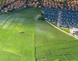
These insights will also help with pinpointing the most attractive opportunities for biodiversity uplift through on-farm habitat creation projects.
For suggestions of different kinds of habitat creation projects, read our blog on examples of natural capital across a farm business.
3. Designing the biodiversity management plan
Science-based insights are vital to guide farmers and land managers in developing a robust, data-informed biodiversity management plan.
This should set out different habitat creation projects that will be put in place across the farm or estate for the purpose of enhancing biodiversity.
Working with a science-based service, such as LAND360, can enable land managers to model the results of potential habitat creation projects and forecast biodiversity gains, so different business options can be compared.
Our Ecosystem+ package involves 1-2-1 time with Fera scientists to combine our Scoring+ data with your farm or estate management records to evaluate land use proposals and potential funding streams.
Through scenario based analysis, conceptual modelling, and economic appraisal, we provide tailored advice on the optimal ways to create sustainable returns from biodiversity gain projects, helping to future proof your land management decisions.
Implementing a biodiversity gain plan with LAND360 support
Rewilding areas within a development can also have various long-term benefits.
Identifying sections of the development site that are less suitable for construction, such as marginal lands, buffer zones, or existing green spaces, can be designated for rewilding, allowing them to naturally evolve into diverse ecosystems that contribute significantly to biodiversity net gain.
This might involve holding back on regular landscaping activities like mowing, fertilising, or planting non-native species, to create conditions where native plants and wildlife can flourish independently.
Wildflower meadows also offer a visually appealing aspect to the development. These meadows require specific management techniques, such as selective weeding and seed collection, to ensure their longevity and ecological value.
More about LAND360
LAND360 is Fera's cutting-edge natural capital assessment service. Launched in 2022, it empowers farmers, landowners, estate managers, and housing developers to make informed land use decisions. By accurately measuring and mapping existing land habitat features and modelling biodiversity offerings, LAND360 is a vital tool in the quest for sustainable development and biodiversity enhancement.