The shift towards paying farmers for environmental goods and services means understanding the natural capital of farmland is set to become vital for growers.
For most producers, measuring natural capital is a new concept which requires new tools, knowledge and services. Thankfully, this is where geospatial science is available to help. Paul Brown, remote sensing scientist at Fera, explains more.
What is remote sensing?
Geospatial science uses remote sensing to identify and collect information about an object or area, without having any physical contact.
Remote sensing refers to information gathered by devices that detect electromagnetic radiation (light from the sun), visible light, infrared light and near-infrared light.
As humans, we’re remote sensing all the time; reading this blog, your eyes are acting as passive sensors that are seeing reflected light which is interacting with the surface of the screen.
The other type of remote sensing is active sensing, where the sensor is also the emitter. Good examples of this are radar imagery and LiDAR (Light Detection and Ranging). LiDAR can often be used to look at the elevation of land.
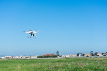
How can remote sensing be used in agriculture?
In agriculture, remote sensing devices such as drones, offer a wide range of uses, from producing measurements of air and soil temperature, to calculating humidity, wind conditions, and inspecting crops and farm buildings.
But with higher-spec technology and satellite imagery, remote sensing has the potential to offer even greater detail. This type of geospatial science can support farmers in making complex decisions about crops and land.
For example, some farming apps and service providers make use of active sensors to analyse the chlorophyll content of plants, helping to identify areas of a field under stress so that growers can react before losses occur.
Fera has been able to make use of remote sensors to look at plant densities and count plants at their early stage of emergence, enabling growers to predict yields of high-value crops.
How can you use geospatial science to support land management decisions?
The shift in government policy towards rewarding farmers providing public goods means remote sensing is likely to become more commonplace in British agriculture.
While we’re still awaiting the full details of the Environmental Land Management scheme, we do know that farmers and land managers will need to understand the natural capital they have on-farm. What’s more, payments could well be linked to this information.
For this to happen, sourcing accurate data will be vital. Although accessing satellite imagery to analyse farmland isn’t necessarily difficult, knowing which images are required and how to analyse geospatial data can be complicated and costly.
This is why approaching a remote sensing provider to help you make sense of the data and find more cost-effective ways to access this information can be valuable. For example, neighbouring farms could come together to split the cost of satellite imagery and analysis between them.
How does LAND360 use remote sensing technology to measure natural capital?
Fera’s LAND360 service utilises satellite imagery alongside Natural England’s biodiversity metric tool to map fields, margins and hedgerows to help farmers measure the types and volume of natural capital they have on their land.
By collating this data and building habitat maps we can then calculate natural capital; from the amount of biodiversity in each parcel of land, to the amount of carbon that’s being stored.
By creating these baselines, producers can look at their land and decide if there are areas where they could change management practices to increase biodiversity or switch a marginal piece of land to a different habitat to increase carbon storage.
Likewise, building this baseline understanding also opens the option to consider the growing number of commercial and private biodiversity and carbon schemes that are currently evolving.
Learn more about the Mapping+ element of Fera’s LAND360 service here.
